
Source: Bureau of Meteorology
For people in parts of Central Tablelands Forecast District.
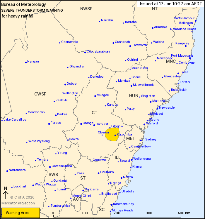
Issued at 10:27 am Saturday, 17 January 2026.
Showers and isolated thunderstorms bring heavy rainfall to parts
of the Blue Mountains.
Weather Situation: A trough along central parts of the coast
generates areas of showers and isolated thunderstorms, with some of
these delivering heavy rainfall.
Severe thunderstorms are likely to produce heavy rainfall that may
lead to flash flooding in the warning area over the next several
hours. Locations which may be affected include Katoomba.
Severe thunderstorms are no longer occurring in the Hunter and
Metropolitan districts and the warning for these districts is
CANCELLED, though the situation is being monitored and further
warnings are possible.
Separate Severe Weather and Coastal Hazard Warnings are current at
the time of issue.
Check
https://www.bom.gov.au/weather-and-climate/warnings-and-alerts for
the latest details.
The State Emergency Service advises that people should:
* Keep clear of creeks and storm drains.
* Don't walk, ride your bike or drive through flood water.
* If you are trapped by flash flooding, seek refuge in the highest
available place and ring 000 if you need rescue.
* Stay indoors away from windows, and keep children and pets
indoors as well.
For emergency help in flood and storms, ring the SES on 132
500.
Stay updated on the Hazards Near Me NSW app or the ACT ESA website
(https://esa.act.gov.au).
16/Jan/2026 11:30 PM

