
Source: Bureau of Meteorology
For people in parts of Mid North Coast and Hunter Forecast
Districts.
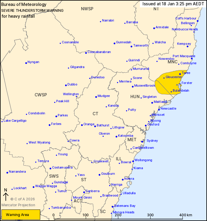
Issued at 3:25 pm Sunday, 18 January 2026.
Heavy rainfall generally easing along coastal New South Wales, but
persisting along the southern Mid North Coast this afternoon.
Weather Situation: A fresh southeasterly flow to the south of a
trough that is moving slowly north along the NSW coast is
continuing to generate showers and isolated thunderstorms about the
Mid North Coast, with some of these bringing heavy rainfall.
Severe thunderstorms may produce heavy rainfall that may lead to
flash flooding in the warning area over the next several hours.
Locations which may be affected include Taree, Gloucester, Forster,
Bulahdelah, Harrington and Old Bar.
74.2 mm OF RAINFALL WAS RECORDED AT WEBBS CREEK (WISEMANS FERRY)
IN THE 2 HOURS TO 8:37 AM.
72.0 mm of rainfall was recorded at Maroota (Tobruk) in the 3
hours to 8:32 am.
The State Emergency Service advises that people should:
* Keep clear of creeks and storm drains.
* Don't walk, ride your bike or drive through flood water.
* If you are trapped by flash flooding, seek refuge in the highest
available place and ring 000 if you need rescue.
* Stay indoors away from windows, and keep children and pets
indoors as well.
For emergency help in flood and storms, ring the SES on 132
500.
Stay updated on the Hazards Near Me NSW app or the ACT ESA website
(https://esa.act.gov.au).
18/Jan/2026 04:28 AM

