
Source: Bureau of Meteorology
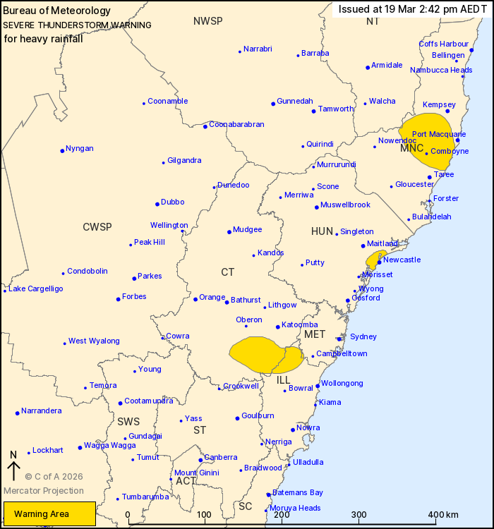
For people in parts of Mid North Coast, Illawarra, Central
Tablelands, Hunter, Metropolitan and Northern Tablelands Forecast
Districts.
Issued at 2:42 pm Thursday, 19 March 2026.
Heavy rainfall possible in showers and isolated
thunderstorms.
Weather Situation: Very moist atmosphere ahead of an upper trough
combining with several subtle surface features to initiate severe
thunderstorms about eastern parts of the state today.
Severe thunderstorms are likely to produce heavy rainfall that may
lead to flash flooding in the warning area over the next several
hours. Locations which may be affected include Newcastle, Comboyne,
Wauchope, Laurieton and Wallsend.
38 mm of rainfall fell at Bankstown Airport in the 30 minutes to
12:54 pm.
The State Emergency Service advises that people should:
* Keep clear of creeks and storm drains.
* Don't walk, ride your bike or drive through flood water.
* If you are trapped by flash flooding, seek refuge in the highest
available place and ring 000 if you need rescue.
* Stay indoors away from windows, and keep children and pets
indoors as well.
For emergency help in flood and storms, ring the SES on 132
500.
Stay updated on the Hazards Near Me NSW app or the ACT ESA website
(https://esa.act.gov.au).
19/Mar/2026 03:50 AM

