
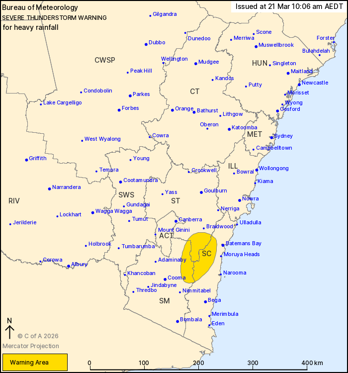
Source: Bureau of Meteorology
For people in parts of South Coast, Southern Tablelands and Snowy
Mountains Forecast Districts.
Issued at 10:06 am Saturday, 21 March 2026.
Slow moving thunderstorms producing heavy rainfall have developed
in the southeast.
Weather Situation: An upper trough in the southeast of the state
is supporting the development of a slow moving cluster of severe
thunderstorms this morning. Storms are moving slowly to the east
and northeast and may persist throughout the remainder of the
morning.
Severe thunderstorms are likely to produce heavy rainfall that may
lead to flash flooding in the warning area over the next several
hours. Locations which may be affected include Araluen.
The State Emergency Service advises that people should:
* Keep clear of creeks and storm drains.
* Don't walk, ride your bike or drive through flood water.
* If you are trapped by flash flooding, seek refuge in the highest
available place and ring 000 if you need rescue.
* Stay indoors away from windows, and keep children and pets
indoors as well.
For emergency help in flood and storms, ring the SES on 132
500.
Stay updated on the Hazards Near Me NSW app or the ACT ESA website
(https://esa.act.gov.au).
20/Mar/2026 11:09 PM

