
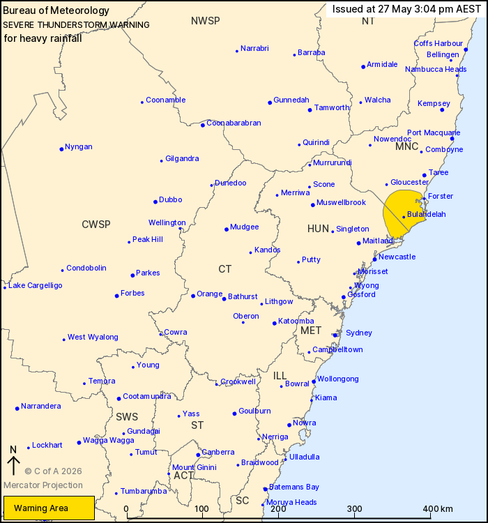
Source: Bureau of Meteorology
For people in parts of Mid North Coast and Hunter Forecast
Districts.
Issued at 3:04 pm Wednesday, 27 May 2026.
Heavy rainfall possible about the Hunter and Mid North Coast
district border.
Weather Situation: A deepening trough over the interior of the
state is expected to gradually move east today. Moisture has
increased to the east of the trough due to a persistent moist
northeasterly airstream, supporting the development of
thunderstorms and showers. This activity may bring locally heavy
rainfall to parts of the state through the afternoon and
evening.
Severe thunderstorms are likely to produce heavy rainfall that may
lead to flash flooding in the warning area over the next several
hours. Locations which may be affected include Bulahdelah and Seal
Rocks.
The State Emergency Service advises that people should:
* Keep clear of creeks and storm drains.
* Don't walk, ride your bike or drive through flood water.
* If you are trapped by flash flooding, seek refuge in the highest
available place and ring 000 if you need rescue.
* Stay indoors away from windows, and keep children and pets
indoors as well.
For emergency help in flood and storms, ring the SES on 132
500.
Stay updated on the Hazards Near Me NSW app or the ACT ESA website
(https://esa.act.gov.au).
27/May/2026 05:08 AM

