
Source: Bureau of Meteorology
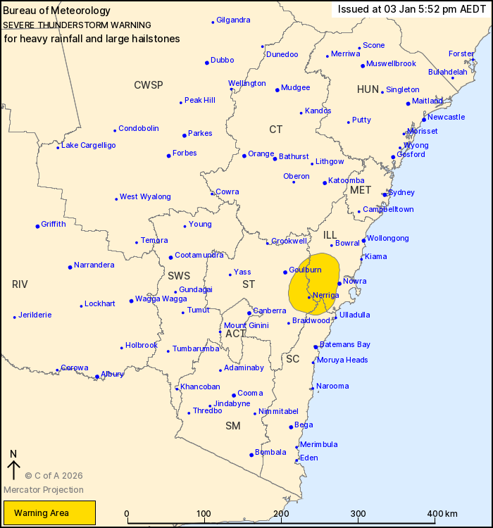
For people in parts of Illawarra, Southern Tablelands and South
Coast Forecast Districts.
Issued at 5:52 pm Saturday, 3 January 2026.
Thunderstorms likely to produce locally heavy rainfall and large
hail over parts of southeast NSW.
Weather Situation: A moist and relatively unstable airmass is in
place over the inland southeast of NSW, with showers and
thunderstorms repeatedly developing and moving along a weak trough
in the area leading to a localised heavy rainfall risk. Stronger
storms may also produce some large hail.
Severe thunderstorms are likely to produce heavy rainfall that may
lead to flash flooding and large hailstones in the warning area
over the next several hours. Locations which may be affected
include Nerriga.
Severe thunderstorms are no longer occurring in the Snowy
Mountains and Australian Capital Territory districts and the
warning for these districts is CANCELLED.
The State Emergency Service advises that people should:
* Park your car under secure cover and away from trees, powerlines
and drains.
* Secure or put away loose items around your house, yard and
balcony.
* Keep clear of creeks and storm drains.
* Don't walk, ride your bike or drive through flood water.
* If you are trapped by flash flooding, seek refuge in the highest
available place and ring 000 if you need rescue.
* Stay indoors away from windows, and keep children and pets
indoors as well.
For emergency help in flood and storms, ring the SES on 132
500.
Stay updated on the Hazards Near Me NSW app or the ACT ESA website
(https://esa.act.gov.au).
03/Jan/2026 07:00 AM


