
Source: Bureau of Meteorology
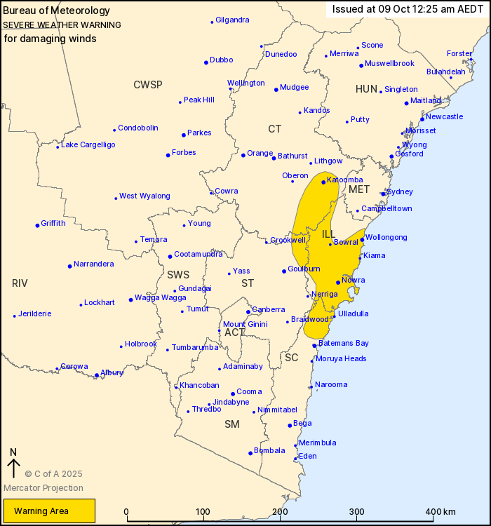
For people in Illawarra and parts of South Coast, Central
Tablelands and Southern Tablelands Forecast Districts.
Issued at 12:25 am Thursday, 9 October 2025.
Damaging wind gusts have developed over the Blue Mountains and are
expected to extend over the Illawarra and South Coast this
morning.
Weather Situation: A vigorous flow has developed over the Blue
Mountains and adjacent areas tonight, this is expected to also
extend over the Illawarra this morning as a cold front passes to
the south, with coastal and low-lying areas particularly at risk of
damaging wind gusts.
Strong west to northwesterly winds averaging 50 to 60 km/h with
DAMAGING WIND GUSTS of around 100 km/h have developed in the Blue
Mountains and are likely to develop over the Illawarra and parts of
the South Coast during the morning period.
Winds are forecast to ease below warning thresholds later this
morning, though gusty winds are expected to persist across the
warning area and surrounds throughout the day.
Locations which may be affected include Wollongong, Nowra, Bowral,
Katoomba, Kiama and Ulladulla.
The State Emergency Service advises that people should:
* Move vehicles under cover or away from trees.
* Secure or put away loose items around your house, yard and
balcony.
* Keep at least 8 metres away from fallen power lines or objects
that may be energised, such as fences.
* Trees that have been damaged by fire are likely to be more
unstable and more likely to fall.
* Report fallen power lines to either Ausgrid (131 388), Endeavour
Energy (131 003), Essential Energy (132 080) or Evoenergy (131 093)
as shown on your power bill.
* Stay vigilant and monitor conditions. Note that the landscape
may have changed following bushfires.
* For emergency help in floods and storms, ring your local SES
Unit on 132 500.
08/Oct/2025 01:33 PM


