
Source: Bureau of Meteorology
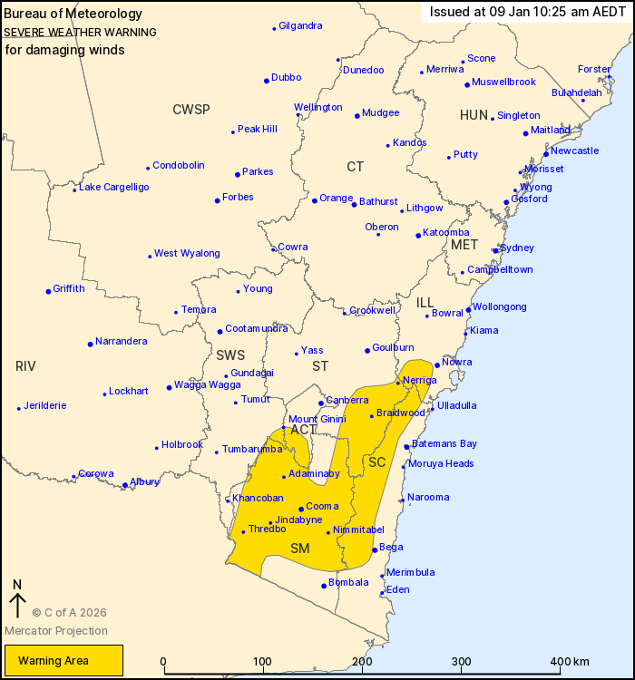
For people in Snowy Mountains and parts of Illawarra, South Coast,
Southern Tablelands, Australian Capital Territory and South West
Slopes Forecast Districts.
Issued at 10:25 am Friday, 9 January 2026.
Damaging winds will develop over parts of the southeast on
Saturday morning.
Weather Situation: West to northwesterly winds are expected to
strengthen ahead of trough that will move through the southeast of
the state during Saturday.
For ALPINE AREAS ABOVE 1900 metres: West to northwesterly DAMAGING
WINDS averaging 80 to 90 km/h with gusts to 120 km/h are likely to
develop from early Saturday morning.
For REMAINING PARTS OF THE WARNING AREA: West to northwesterly
winds averaging 50 to 60 km/h with DAMAGING WIND GUSTS up to 100
km/h will develop after sunrise and continue into the early
afternoon.
Conditions throughout the warning area are expected to ease by
mid-afternoon.
Locations which may be affected include Cooma, Braidwood, Nerriga,
Mount Ginini, Jindabyne, Thredbo, Adaminaby, Nimmitabel and
Araluen.
The State Emergency Service advises that people should:
* Park your car under secure cover and away from trees, powerlines
and drains.
* Secure or put away loose items around your house, yard and
balcony.
* Keep at least 8 metres away from fallen power lines or objects
that may be energised, such as fences.
* Report fallen power lines to either Ausgrid (131 388), Endeavour
Energy (131 003), Essential Energy (132 080) or Evoenergy (131 093)
as shown on your power bill.
For emergency help in flood and storms, ring the SES on 132
500.
Stay updated on the Hazards Near Me NSW app or the ACT ESA website
(https://esa.act.gov.au).
08/Jan/2026 11:32 PM


