
Source: Bureau of Meteorology
Issued at 11:51 am ACST on Saturday 21 March 2026
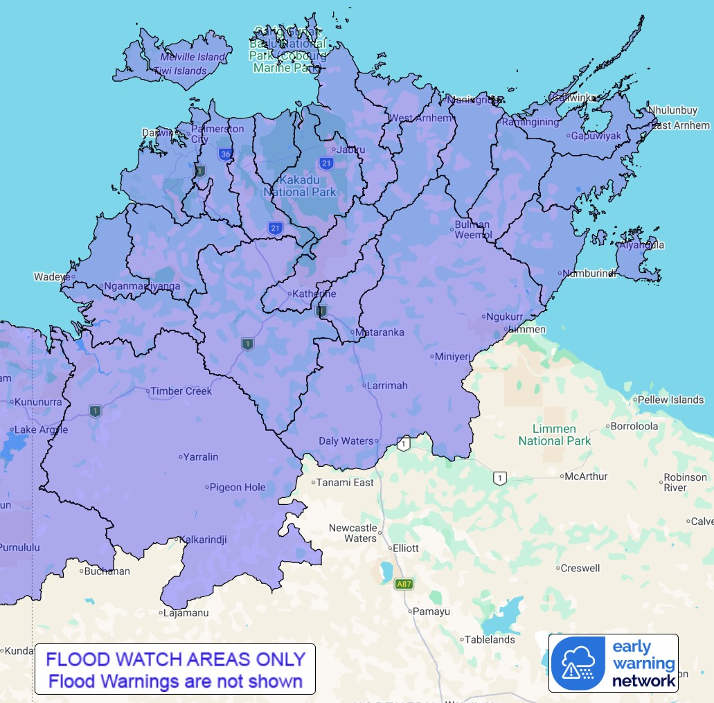
Flood Watch Number: 3
ADDITIONAL AREAS OF MAJOR FLOODING POSSIBLE ACROSS PARTS OF THE
TOP END FROM SUNDAY
Tropical Cyclone Narelle is currently tracking westward through
the Gulf of Carpentaria. The system is forecast to cross into the
Northern Territory overnight Saturday into Sunday.
Major flooding is continuing in the Daly River. Tropical Cyclone
Narelle is forecast to bring widespread heavy to locally intense
rainfall to parts of the Top End from overnight Saturday.
Catchments are wet to saturated across the Top End, and rivers and
creeks will respond rapidly to heavy rainfall.
River and creek level rises are likely and additional areas of
minor to major flooding may develop from Sunday morning. Roads may
be affected, and some communities may become isolated. Check road
conditions before travelling.
Catchments likely to be affected include:
East Kimberley Rivers
Victoria River below Kalkarindji(Flooding more likely in northern
parts)
Fitzmaurice River
Moyle River
Katherine River(Major flood warning current)
Daly River above Douglas River
Lower Daly River(Major flood warning current)
Finniss River
Tiwi Islands
Upper Adelaide River(Moderate flood warning current)
Adelaide River below Adelaide River Town
Mary River
Wildman River
South Alligator River
East Alligator River
Goomadeer River
Liverpool River
Blyth River
Goyder River
Buckingham River
Koolatong River
Walker River
Waterhouse River(Major flood warning current)
Roper River
Groote Eylandt
Flood warnings are current for the following catchment(s) :
Katherine, Lower Daly, Upper Adelaide and Waterhouse. A Tropical
Cyclone advice is current for parts of Northern Territory.
For the latest flood and weather warnings see
www.bom.gov.au/weather-and-climate/warnings-and-alerts
For the latest rainfall and river level information see
www.bom.gov.au/australia/flood
Rainfall and River
Conditions Map
21/Mar/2026 02:50 AM

