
Source: Bureau of Meteorology
Issued at 12:32 pm AEST on Sunday 15 March 2026
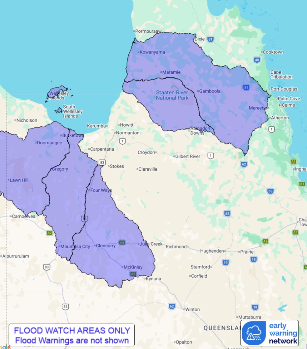
Flood Watch Number: 14
FURTHER FLOODING POSSIBLE ACROSS PARTS OF THE GULF COUNTRY AND
CAPE YORK PENINSULA
A trough will extend from the Coral Sea over northern Cape York
Peninsula from early in the coming week. Showers and thunderstorms
will continue across Far North Queensland before contracting
towards the northern Cape from Monday. Further flooding is possible
across parts of the Flood Watch area over the next few days .
Catchments across the Flood Watch area are wet to saturated from
recent rainfall, and are expected to respond quickly to further
heavy rainfall.
Further river level rises and localised flooding are possible in
areas of heavy rainfall. Disruption to transport routes is likely
across parts of the Flood Watch area.
Widespread minor to major flooding continues across large parts of
Queensland, with multiple Flood Warnings current.
Catchments likely to be affected include:
Nicholson River
Leichhardt River
Cloncurry River
Staaten River
Mitchell River(elevated levels expected along Magnificent Creek at
Kowanyama)
For the latest flood and weather warnings see
www.bom.gov.au/weather-and-climate/warnings-and-alerts
For the latest rainfall and river level information see
www.bom.gov.au/australia/flood
Safety Advice:
Don't drive, walk, swim or play in floodwater because it is
dangerous.
Stay away from flooded drains, rivers, streams and
waterways.
Obey road closure signs. Plan ahead so you don't drive on flooded
roads.
Check the ABC and local media for updates. The situation can
change quickly, so stay informed.
For local emergency management warnings and advice visit
www.disaster.qld.gov.au/warnings.
For emergency assistance call SES on telephone number 132 500. In
life-threatening emergencies, call 000 (triple zero)
immediately.
Rainfall and River
Conditions Map
15/Mar/2026 02:55 AM

