
Source: Bureau of Meteorology
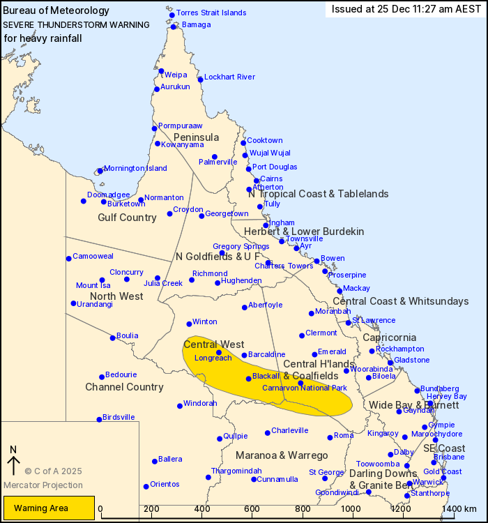
For people in parts of Central Highlands and Coalfields, Central
West, Maranoa and Warrego and Channel Country Forecast
Districts.
Issued at 11:27 am Thursday, 25 December 2025.
Heavy rainfall continuing about the central interior.
Weather Situation: Slow moving severe thunderstorms are occurring
in a moist and unstable environment this morning through central
interior parts of Queensland.
Severe thunderstorms are likely to produce heavy rainfall that may
lead to flash flooding in the warning area over the next several
hours. Locations which may be affected include Longreach, Blackall,
Carnarvon National Park, Isisford, Tambo and Evesham Station.
Severe thunderstorms are no longer occurring in the Capricornia
and Wide Bay and Burnett districts and the warning for these
districts is CANCELLED.
117.5 mm WAS RECORDED AT CANIA DAM IN THE 3 HOURS TO 5:48
AM.
119.0 mm WAS RECORDED AT BLUE HILLS IN THE 6 HOURS TO 7:59
AM.
68 mm was recorded at Sardine Creek in the 1 hour to 11:24
am.
85.0 mm was recorded at Caniaview the 3 hours to 5:42 am.
52 mm was recorded at Ravensbourne in 1 hour to 9:45 am.
Emergency services advise people to:
* Park your car undercover away from trees.
* Close doors and windows.
* Keep asthma medications close by. Storms and wind can trigger
asthma attacks.
* Charge mobile phones and power banks in case the power goes
out.
* Put your pets somewhere safe and make sure they can be
identified in case they get lost.
* Do not drive now unless you have to because conditions are
dangerous.
* Tell friends, family and neighbours in the area.
* Go inside a strong building now. Stay inside until the storm has
passed.
25/Dec/2025 01:34 AM

