
Source: Bureau of Meteorology
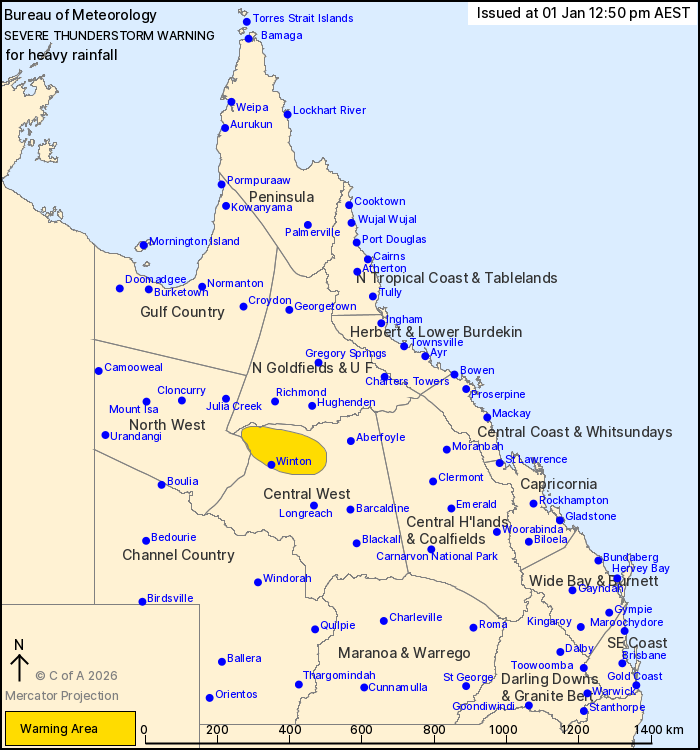
For people in parts of Central West, Northern Goldfields and Upper
Flinders and North West Forecast Districts.
Issued at 12:50 pm Thursday, 1 January 2026.
Slow moving thunderstorms are developing in the Central West this
afternoon.
Weather Situation: A tropical low and associated trough lying
across the northwest and northern interior of Queensland continue
to generate slow moving storms and heavier falls this afternoon. In
the southeast more isolated thunderstorms are expected to develop
in the afternoon.
Severe thunderstorms are likely to produce heavy rainfall that may
lead to flash flooding in the warning area over the next several
hours. Locations which may be affected include Winton and
Corfield.
A separate Severe Weather Warning is current for the northeast
tropical coast. Flood Watches and Flood Warnings are current for
Central and Northern Queensland. Please refer to
https://www.bom.gov.au/weather-and-climate/warnings-and-alerts for
more information.
Emergency services advise people to:
* Park your car undercover away from trees.
* Close doors and windows.
* Keep asthma medications close by. Storms and wind can trigger
asthma attacks.
* Charge mobile phones and power banks in case the power goes
out.
* Put your pets somewhere safe and make sure they can be
identified in case they get lost.
* Do not drive now unless you have to because conditions are
dangerous.
* Tell friends, family and neighbours in the area.
* Go inside a strong building now. Stay inside until the storm has
passed.
01/Jan/2026 02:57 AM


