
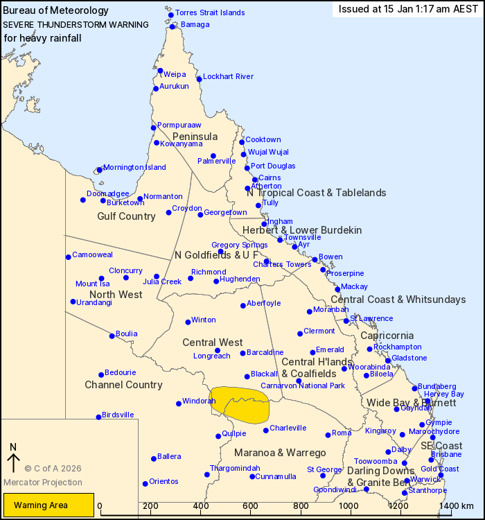
Source: Bureau of Meteorology
For people in parts of Central West, Maranoa and Warrego and
Channel Country Forecast Districts.
Issued at 1:17 am Thursday, 15 January 2026.
Slow moving thunderstorms producing heavy rainfall over central
parts of the state during the early morning.
Weather Situation: A very moist airmass remains in place across
central parts of Queensland. Surface troughs combining with this
warm and humid environment are producing localised heavy rainfall
in slow moving thunderstorms.
Severe thunderstorms are likely to produce heavy rainfall that may
lead to flash flooding in the warning area over the next several
hours.
60 mm was recorded at Boondoon in 2 hours to 12:40am
37.8 mm was recorded at Charleville Aero in 30 minutes to 10:59
pm
37 mm was recorded at The 27 Mile Garden in 30 minutes to 11:17
pm
Emergency services advise people to:
* Park your car undercover away from trees.
* Close doors and windows.
* Keep asthma medications close by. Storms and wind can trigger
asthma attacks.
* Charge mobile phones and power banks in case the power goes
out.
* Put your pets somewhere safe and make sure they can be
identified in case they get lost.
* Do not drive now unless you have to because conditions are
dangerous.
* Tell friends, family and neighbours in the area.
* Go inside a strong building now. Stay inside until the storm has
passed.
14/Jan/2026 03:22 PM

