
Source: Bureau of Meteorology
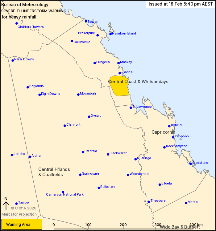
For people in parts of Central Coast and Whitsundays Forecast
District.
Issued at 5:40 pm Wednesday, 18 February 2026.
Heavy rainfall with thunderstorms in the central east.
Weather Situation: A trough extending from the Central Coast
through to the Gulf Country combines with a humid airmass to
trigger slow moving thunderstorms with the risk of heavy
rainfall.
Severe thunderstorms are likely to produce heavy rainfall that may
lead to flash flooding in the warning area over the next several
hours.
Separate Flood Watches and/or Warnings are current at the time of
issue. Check
https://www.bom.gov.au/weather-and-climate/warnings-and-alerts.
Emergency services advise people to:
* Park your car undercover away from trees.
* Close doors and windows.
* Keep asthma medications close by. Storms and wind can trigger
asthma attacks.
* Charge mobile phones and power banks in case the power goes
out.
* Put your pets somewhere safe and make sure they can be
identified in case they get lost.
* Do not drive now unless you have to because conditions are
dangerous.
* Tell friends, family and neighbours in the area.
* Go inside a strong building now. Stay inside until the storm has
passed.
18/Feb/2026 07:45 AM

