
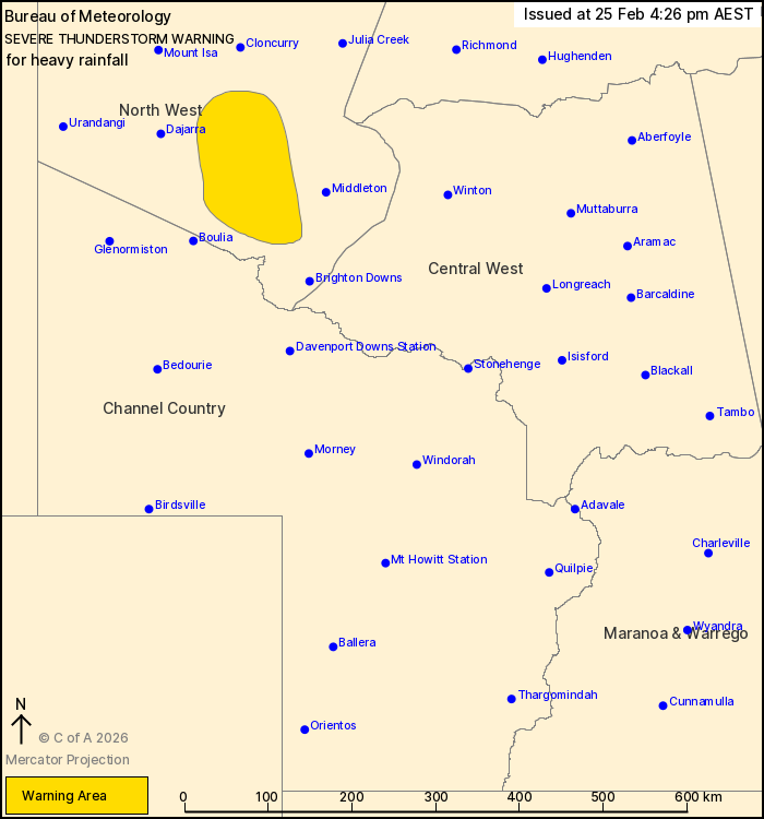
Source: Bureau of Meteorology
For people in parts of North West Forecast District.
Issued at 4:26 pm Wednesday, 25 February 2026.
Slow moving thunderstorms causing areas of heavy rainfall have
developed in the North West.
Weather Situation: A surface trough extends from a tropical low
based in the southeastern Northern Territory through to western
inland districts of Queensland. Slow moving clusters of
thunderstorms have developed along the trough and will cause areas
of heavy rainfall throughout the remainder of the afternoon and
into the early evening.
Severe thunderstorms are likely to produce heavy rainfall that may
lead to flash flooding in the warning area over the next several
hours. Locations which may be affected include Selwyn.
A broader Severe Weather Warning for heavy and locally intense
rainfall is also current for areas of the Channel Country and
Maranoa and Warrego Districts. For more information, refer to
https://www.bom.gov.au/weather-and-climate/warnings-and-alerts
Emergency services advise people to:
* Park your car undercover away from trees.
* Close doors and windows.
* Keep asthma medications close by. Storms and wind can trigger
asthma attacks.
* Charge mobile phones and power banks in case the power goes
out.
* Put your pets somewhere safe and make sure they can be
identified in case they get lost.
* Do not drive now unless you have to because conditions are
dangerous.
* Tell friends, family and neighbours in the area.
* Go inside a strong building now. Stay inside until the storm has
passed.
25/Feb/2026 06:30 AM

