
Source: Bureau of Meteorology
For people in parts of Central Highlands and Coalfields and
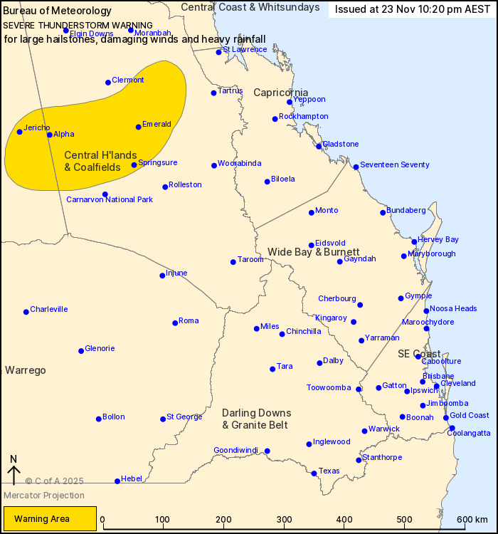
Central West Forecast Districts.
Issued at 10:20 pm Sunday, 23 November 2025.
Severe thunderstorms redeveloping through central parts of the
state.
Weather Situation: A broad moist and unstable airmass is
triggering severe thunderstorms through parts of central Queensland
.
Severe thunderstorms are likely to produce large hailstones,
damaging winds and heavy rainfall that may lead to flash flooding
in the warning area over the next several hours. Locations which
may be affected include Emerald, Springsure, Capella, Dysart,
Bogantungan and Comet.
7-8CM HAIL REPORTED FROM TANAH MERAH (BETWEEN LOGAN AND BEENLEIGH)
AT 7:30PM.
4cm hail reported from Beenleigh at 7:30pm.
4-5cm hail reported from Cedar Creek (near Tamborine Mountain) at
7:15pm.
4-5cm hail reported from Biddaddaba (east of Beaudesert) at
7pm.
7CM HAIL REPORTED FROM CANUNGRA AT 6:30PM.
7-8CM HAIL REPORTED FROM CAINABLE (SOUTHEAST OF BEAUDESERT) AT
6:30PM.
Emergency services advise people to:
* Park your car undercover away from trees.
* Close doors and windows.
* Keep asthma medications close by. Storms and wind can trigger
asthma attacks.
* Charge mobile phones and power banks in case the power goes
out.
* Put your pets somewhere safe and make sure they can be
identified in case they get lost.
* Do not drive now unless you have to because conditions are
dangerous.
* Tell friends, family and neighbours in the area.
* Go inside a strong building now. Stay inside until the storm has
passed.
23/Nov/2025 12:25 PM

