
Source: Bureau of Meteorology
Issued at 12:45 pm ACDT on Friday 20 February 2026 Flood Watch
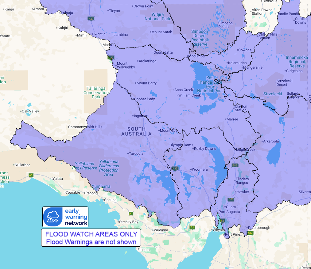
Number: 1
FLOODING LIKELY IN PARTS OF THE NORTH-EASTERN AND CENTRAL
CATCHMENTS FROM SUNDAY
A trough over northern South Australia, connected to a deepening
tropical low over the south of the Northern Territory, will combine
with a very humid and unstable airmass to produce widespread heavy
rainfall and thunderstorms over the north of the state from Sunday
through to at least mid-next week.
The risk of local heavy falls will develop from Sunday for much of
the state ahead of a front extending across the south. From Monday
the focus of the heavy falls and flooding is likely to be over the
Pastoral districts closer to the low.
River and creek level rises, localised flooding, and overland
inundation are likely in parts of the Flood Watch area from Sunday.
This may affect road access, and some communities may become
isolated. Check road conditions before travelling.
Catchments likely to be affected include:
Flinders Ranges Rivers and Creeks
North West Lake Torrens
Warburton River
Cooper Creek
Lake Eyre
Lake Frome
Finke River and Stephenson Creek
Simpson Desert
Lake Gairdner
For the latest flood and weather warnings see
www.bom.gov.au/weather-and-climate/warnings-and-alerts
For the latest rainfall and river level information see
www.bom.gov.au/australia/flood
Safety Advice:
* Don't drive, walk, swim or play in floodwater because it is
dangerous.
* Stay away from flooded drains, rivers, streams and
waterways.
* Obey road closure signs. Plan ahead so you don't drive on
flooded roads.
* Check the ABC and local media for updates. The situation can
change quickly, so stay informed.
* For local emergency management warnings and advice visit
www.ses.sa.gov.au/incidents-and-warnings/incidents-and-warnings-map/.
Rainfall and River
Conditions Map
20/Feb/2026 02:31 AM

