
Source: Bureau of Meteorology
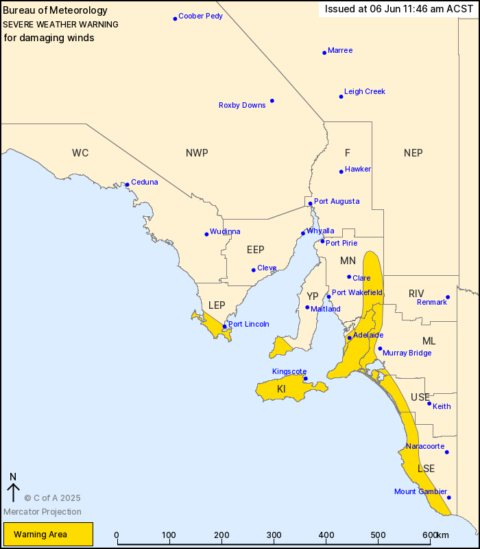
For people in Adelaide Metropolitan, Mount Lofty Ranges, Kangaroo
Island and parts of Lower Eyre Peninsula, Yorke Peninsula, Mid
North, Murraylands, Upper South East and Lower South East
districts.
Issued at 11:46 am Friday, 6 June 2025.
Damaging winds developing this evening, becoming likely
tomorrow.
Weather Situation: A complex low located over the Southern Ocean
is extending multiple frontal systems over South Australia today
and tomorrow. The stronger frontal passages with risk of damaging
west to southwesterly winds are expected for this evening and
Saturday afternoon, with a lull in the winds in between.
For COASTAL AREAS including ADELAIDE METRO AREA: Strong to
DAMAGING WINDS averaging 55 to 65 km/h with peak gusts in excess of
90 km/h are possible from this afternoon and into the evening,
before easing temporarily early Saturday morning. Winds will pick
up again late Saturday morning, with DAMAGING WINDS averaging 65
km/h with peak gusts in excess of 90 km/h becoming likely during
Saturday afternoon.
For ELEVATED AREAS including MOUNT LOFTY RANGES, FLINDERS RANGES:
Isolated DAMAGING WIND GUSTS with peak gusts in excess of 90 km/h
are possible this afternoon and evening, before easing temporarily
early Saturday morning. Winds will pick up again late Saturday
morning, with DAMAGING WIND GUSTS with peak gusts in excess of 90
km/h becoming likely from late Saturday morning and into the
afternoon.
Winds are forecast to ease below warning thresholds for most areas
during Saturday evening, however, exposed coastal areas may see a
risk of DAMAGING WIND GUSTS continue until the late evening.
Locations which may be affected include Adelaide, Kingscote,
Victor Harbor, Meningie, Burra and Millicent.
The State Emergency Service advises that people should:
* Move vehicles under cover or away from trees;
* Secure or put away loose items around your property.
* Stay indoors, away from windows, while conditions are
severe.
06/Jun/2025 02:25 AM

