
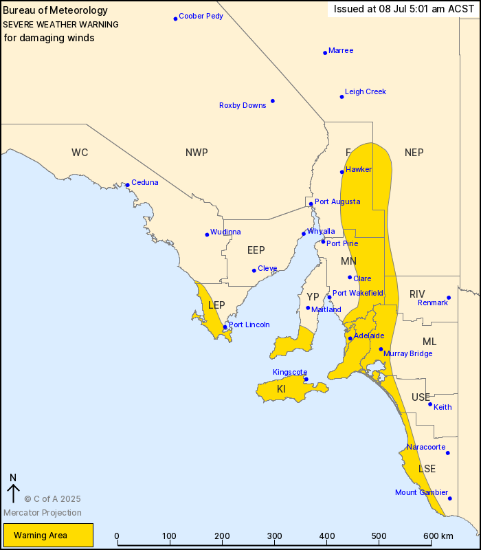
Source: Bureau of Meteorology
For people in Adelaide Metropolitan, Mount Lofty Ranges, Kangaroo
Island and parts of Lower Eyre Peninsula, Yorke Peninsula,
Flinders, Mid North, Riverland, Murraylands, Upper South East,
Lower South East, West Coast and North East Pastoral
districts.
Issued at 5:01 am Tuesday, 8 July 2025.
Damaging winds continue about southern coasts and elevated areas
today.
Weather Situation: An approaching cold front is bringing damaging
northwest to westerly winds this morning, easing by late
afternoon.
DAMAGING WINDS averaging 60 to 70 km/h with peak gusts of up to
100 km/h are occurring about the Adelaide Metropolitan Area, Mount
Lofty Ranges, Yorke Peninsula and Kangaroo Island this morning, and
forecast to extend throughout the rest of the warning area from
around sunrise.
Winds are forecast to ease about the coastal areas, including
Kangaroo Island, in the early afternoon. Winds about the elevated
areas are expected to ease by late this afternoon.
Locations which may be affected include Adelaide, Murray Bridge,
Kingscote, Gawler, Victor Harbor, Meningie, Jamestown, Burra and
Peterborough.
102 km/h wind gust was recorded at Cape Willoughby at 1:45 am
ACST
98 km/h wind gust was recorded at Edithburgh at 4:38 am ACST
96 km/h wind gust was recorded at Outer Harbor Tide Gauge at 3:41
am ACST
94 km/h wind gust was recorded at Minlaton Airport at 3:37 am
ACST
91 km/h wind gust was recorded at Black Pole at 3:33 am ACST
The State Emergency Service advises that people should:
* Move vehicles under cover or away from trees;
* Secure or put away loose items around your property.
* Stay indoors, away from windows, while conditions are
severe.
07/Jul/2025 09:18 PM

