
Source: Bureau of Meteorology
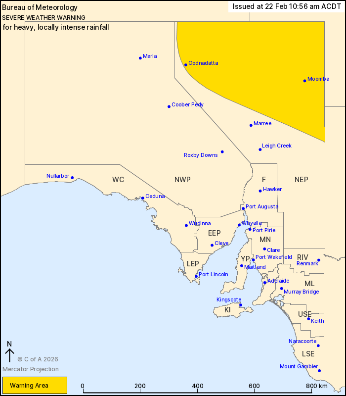
For people in parts of North East Pastoral district.
Issued at 10:56 am Sunday, 22 February 2026.
HEAVY TO LOCALLY INTENSE RAINFALL DEVELOPING ABOUT THE NORTHEAST
FROM SUNDAY NIGHT
Weather Situation: A slow moving low pressure system located over
the southern Northern Territory is surrounded by an extremely humid
airmass. This is interacting with an approaching cold front and
upper trough to produce widespread rainfall across South Australia,
becoming severe about the northeast tonight. The low pressure
system is likely to linger in the area for the next several days,
bringing further periods of heavy rainfall.
HEAVY RAINFALL which may lead to FLASH FLOODING is forecast for
parts of the North East Pastoral district from Sunday evening.
Six-hourly rainfall totals between 30 and 60 mm are likely.
24-hourly rainfall totals between 50 and 80 mm are likely, with
isolated totals to 100 mm.
Locally INTENSE RAINFALL which may lead to DANGEROUS AND
LIFE-THREATENING FLASH FLOODING is also possible, more likely with
embedded thunderstorms in the area. Six-hourly rainfall totals of
around 90 mm are possible.
This is likely to be a prolonged event for northeast South
Australia. Periods of heavy rainfall are likely for most of the
week.
Flood Watches and Warnings are current for the area. Please refer
to https://www.bom.gov.au/weather-and-climate/warnings-and-alerts/
for more information.
Locations which may be affected include Moomba, Oodnadatta,
Innamincka, Dalhousie Springs, the Simpson Desert Conservation Park
and Mungeranie on the Birdsville Track.
The State Emergency Service advises that people should:
* Don't drive, ride or walk through flood water;
* Keep clear of creeks and storm drains;
22/Feb/2026 12:33 AM

