
Source: Bureau of Meteorology
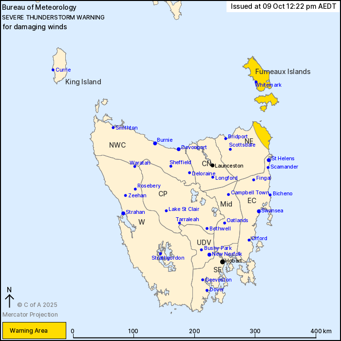
For people in Furneaux Islands and parts of North East Forecast
Districts.
Issued at 12:22 pm Thursday, 9 October 2025.
A line of gusty thunderstorms moving east along the northeast
coast of Tasmania and Furneaux Islands this morning.
Weather Situation: Strong and unstable northwesterly flow ahead of
an approaching cold front is producing a line of severe
thunderstorms across northern Tasmania this morning, which will
move rapidly eastwards and clear the east of the State in an hour
or two.
Severe thunderstorms are likely to produce damaging winds in the
warning area over the next several hours. Locations which may be
affected include Whitemark.
Severe thunderstorms are no longer occurring in the North West
Coast and Central North districts and the warning for these
districts is CANCELLED.
113 km/h wind gust was observed at Devonport at 9:16am.
The State Emergency Service advises that people should:
* Move your car under cover or away from trees.
* Secure loose outdoor items.
* Seek shelter, preferably indoors and never under trees.
* Avoid using the telephone during a thunderstorm.
* Beware of fallen trees and powerlines.
* For emergency assistance contact the SES on 132500.
09/Oct/2025 01:32 AM


