
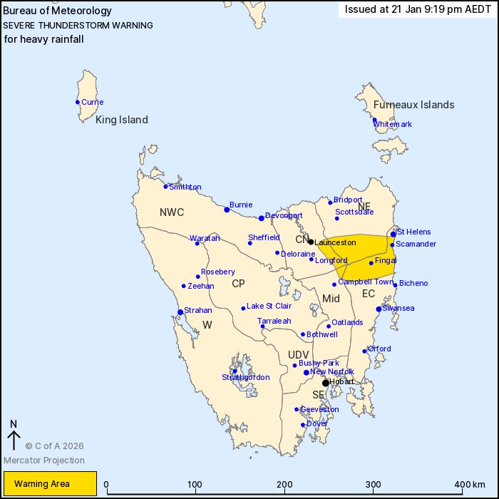
Source: Bureau of Meteorology
For people in parts of North East, East Coast, Central North and
Midlands Forecast Districts.
Issued at 9:19 pm Wednesday, 21 January 2026.
Heavy rainfall continuing over parts of northeast Tasmania,
although contracting east and easing.
Weather Situation: The passage of a cold front combines with an
upper-level trough and high atmospheric moisture to generate severe
thunderstorms with heavy rainfall over parts of northeast Tasmania
this evening.
Severe thunderstorms are likely to produce heavy rainfall that may
lead to flash flooding in the warning area over the next several
hour or two. Locations which may be affected include Fingal and
Scamander. Thunderstorms and heavy rainfall are gradually
contracting eastward and easing.
Severe thunderstorms are no longer occurring in the South East,
North West Coast and Central Plateau districts and the warning for
these districts is CANCELLED.
87.2 MM OF RAINFALL WAS RECORDED AT LLEWELLYN IN THE 3 HOURS TO
7:14 PM.
The State Emergency Service advises that people should:
* Avoid driving, walking or riding through flood waters.
* Seek shelter, preferably indoors and never under trees.
* Avoid using the telephone during a thunderstorm.
* Beware of fallen trees and powerlines.
* For emergency assistance contact the SES on 132500.
21/Jan/2026 10:25 AM

