
Source: Bureau of Meteorology
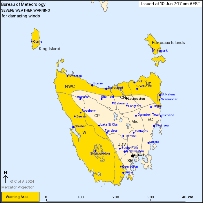
For people in King Island, Furneaux Islands, Western, North East,
North West Coast and parts of Upper Derwent Valley, South East,
East Coast, Central North and Central Plateau Forecast
Districts.
Issued at 7:17 am Monday, 10 June 2024.
Damaging winds to impact northern and western Tasmania from early
Tuesday morning.
Weather Situation: A cold front is forecast to pass over Tasmania
on Tuesday and produce a vigorous northwesterly flow ahead of it,
resulting in damaging winds for northern and western parts of the
state.
DAMAGING WINDS averaging around 70 km/h with peak gusts in excess
of 100 km/h are likely from early Tuesday morning over northern and
western districts, including the Furneaux Islands and King
Island.
Damaging winds are forecast to ease below warning thresholds by
Tuesday evening.
Locations which may be affected include Devonport, Burnie, St
Helens, Strahan, Geeveston and Dover.
The State Emergency Service advises that people should:
* Supervise children closely.
* Check that family and neighbours are aware of warnings.
* Manage pets and livestock.
* Secure outdoor items including furniture and play
equipment.
* Be prepared in case of power outages and report any outages to
TasNetworks on 132 004.
* Beware of damaged trees and power lines and take care when
driving.
* Listen to the ABC radio or check www.ses.tas.gov.au for further
advice.
* For emergency assistance contact the SES on 132500.
09/Jun/2024 09:36 PM

