
Source: Bureau of Meteorology
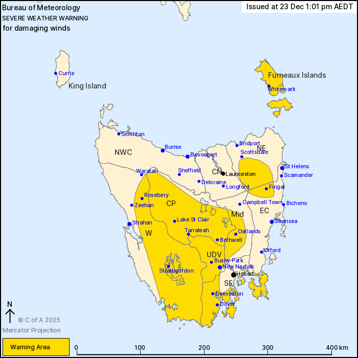
For people in Furneaux Islands, Western, Upper Derwent Valley,
South East, Central Plateau and parts of North East, East Coast,
Midlands and Central North Forecast Districts.
Issued at 1:01 pm Tuesday, 23 December 2025.
Damaging wind gusts possible on Wednesday as a cold front moves
across the state.
Weather Situation: A cold front is expected to move through
Tasmania tonight and early tomorrow morning, with strong westerly
winds aloft. Damaging wind gusts are possible over elevated peaks
as the front approaches, as well as in showers in the wake of the
front.
West to southwesterly winds averaging 50 to 60 km/h are likely on
Wednesday, with DAMAGING WIND GUSTS of 100 km/h possible in
elevated parts of the warning area from Wednesday morning and
extending throughout the warning area in showers on Wednesday
afternoon.
Winds are expected to ease by Wednesday evening as the front moves
into the Tasman Sea.
Locations which may be affected include New Norfolk, Oatlands,
Whitemark, Bothwell, Geeveston and Dover.
The State Emergency Service advises that people should:
* Supervise children closely.
* Check that family and neighbours are aware of warnings.
* Manage pets and livestock.
* Secure outdoor items including furniture and play
equipment.
* Be prepared in case of power outages and report any outages to
TasNetworks on 132 004.
* Beware of damaged trees and power lines and take care when
driving.
* Listen to the ABC radio or check www.ses.tas.gov.au for further
advice.
* For emergency assistance contact the SES on 132500.
23/Dec/2025 02:16 AM

