Source: Bureau of Meteorology
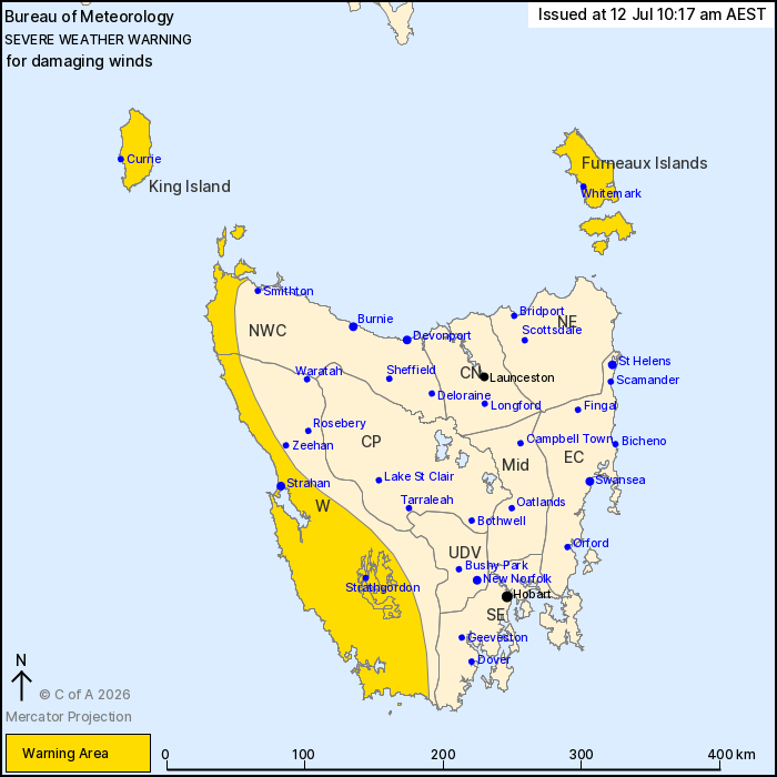
For people in King Island, Furneaux Islands and parts of Western
and North West Coast Forecast Districts.
Issued at 10:17 am Sunday, 12 July 2026.
Damaging winds developing on Monday across the southwest, west
coast and Bass Strait Islands
Weather Situation: A series of fronts cross Tasmania during
Monday, bringing increased westerly flow.
Across the southwest corner: DAMAGING WINDS averaging 60 to 70
km/h with gusts in excess of 110 km/h are forecast to develop
during Monday morning.
For parts of the west coast, northwest coast and the Bass Strait
Islands: DAMAGING WINDS averaging 55 to 65 km/h with possible gusts
in excess of 100 km/h from Monday afternoon, with the strongest
gusts likely with shower activity.
Winds are forecast to ease from the southwest during Monday
evening, clearing the Furneaux Islands by late Monday night.
Locations which may be affected include Strahan, Currie, Whitemark
and Strathgordon.
The State Emergency Service advises that people should:
* Supervise children closely.
* Check that family and neighbours are aware of warnings.
* Manage pets and livestock.
* Secure outdoor items including furniture and play
equipment.
* Be prepared in case of power outages and report any outages to
TasNetworks on 132 004.
* Beware of damaged trees and power lines and take care when
driving.
* Listen to the ABC radio or check www.ses.tas.gov.au for further
advice.
* For emergency assistance contact the SES on 132500.
12/Jul/2026 12:22 AM