
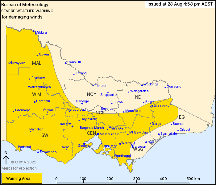
Source: Bureau of Meteorology
For people in Central, Mallee, South West, North Central, West and
South Gippsland, Wimmera and parts of East Gippsland, North East
and Northern Country Forecast Districts.
Issued at 4:58 pm Thursday, 28 August 2025.
Widespread damaging winds developing Friday, with blizzards
possible for alpine areas.
Weather Situation: A strong northwesterly airstream will develop
across the state early on Friday morning ahead of an approaching
frontal system in the west. From the afternoon a vigorous
southwesterly airstream will follow the passage of the low, with
the ranges and southern areas of the state at particular risk of
widespread damaging winds. This flow will persist for 3 to 6 hours
at any location before gradually easing.
For the EASTERN RANGES: DAMAGING NORTHWESTERLY WINDS averaging 65
to 75 km/h with peak gusts around 110 km/h are likely to develop
early on Friday morning, before tending SOUTHWESTERLY on Saturday
morning and easing by the afternoon.
For the GRAMPIANS and CENTRAL RANGES: DAMAGING NORTHWESTERLY WINDS
averaging 55 to 65 km/h with peak gusts around 100 km/h are likely
to develop before sunrise, tending WESTERLY and continuing into
Friday afternoon. Winds may ease for a period in the early evening,
before DAMAGING SOUTHWESTERLY WINDS averaging 60 to 70 km/h with
gusts around 110 km/h develop in the late evening. Winds will ease
during Saturday morning.
For WESTERN VICTORIA: DAMAGING WIND GUSTS around 90 km/h are
possible in showers and isolated thunderstorms on and behind the
front, beginning in the west mid-morning on Friday before extending
to northern districts in the afternoon, easing in the
evening.
For SOUTHERN VICTORIA including MELBOURNE and GEELONG: DAMAGING
SOUTHWESTERLY WINDS averaging 55 to 65 km/h with gusts around 100
km/h are expected to develop in the Southwest district from Friday
afternoon, extending into the Central and North Central districts
including MELBOURNE and GEELONG during the evening. Winds should
peak over Melbourne in the early hours of Saturday morning. Winds
averaging 70 to 80 km/h with gusts around 115 km/h are possible
along exposed coastal towns, particularly west of Cape Otway and
for the Mornington Peninsula and Bass Coast for a period. Winds are
expected to begin easing from the west during Friday evening.
BLIZZARD conditions are forecast for parts of the Eastern Ranges
above 1200m.
Locations which may be affected include Melbourne, Geelong,
Mildura, Horsham, Warrnambool, Bendigo, Seymour, Maryborough,
Ballarat, Mt Hotham and Mt Buller.
The State Emergency Service advises that people should:
* If driving conditions are dangerous, safely pull over away from
trees, drains, low-lying areas and floodwater. Avoid travel if
possible.
* Stay safe by avoiding dangerous hazards, such as floodwater,
mud, debris, damaged roads and fallen trees.
* Be aware - heat, fire or recent storms may make trees unstable
and more likely to fall when it's windy or wet.
* Check that loose items, such as outdoor settings, umbrellas and
trampolines are safely secured. Move vehicles under cover or away
from trees.
* Stay indoors and away from windows.
* If outdoors, move to a safe place indoors. Stay away from trees,
drains, gutters, creeks and waterways.
* Stay away from fallen powerlines - always assume they are
live.
* Be aware that in fire affected areas, rainfall run-off into
waterways may contain debris such as ash, soil, trees and rocks.
Heavy rainfall may also increase the potential for landslides and
debris across roads.
* Stay informed: Monitor weather warnings, forecasts and river
levels at the Bureau of Meteorology website, and warnings through
VicEmergency website/app/hotline.
28/Aug/2025 07:06 AM

