
Source: Bureau of Meteorology
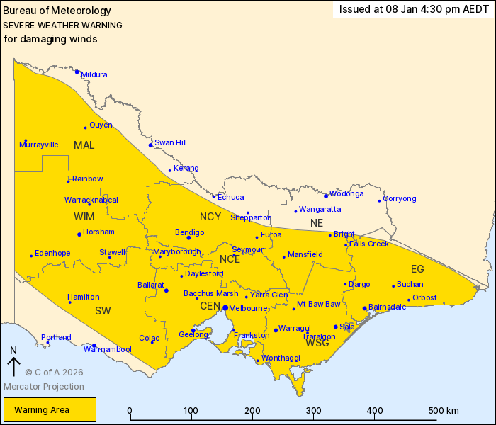
For people in Central, East Gippsland, Mallee, South West,
Northern Country, North Central, West and South Gippsland, Wimmera
and parts of North East Forecast Districts.
Issued at 4:30 pm Thursday, 8 January 2026.
Damaging wind gusts developing across large parts of Victoria on
Friday.
Weather Situation: Gusty northwesterly winds are expected to
develop from Friday morning, mainly about the ranges, while a cool
change moving through the state will produce broadscale
thunderstorm activity increasing the risk for damaging wind gusts
across the state during the afternoon and early evening. Conditions
will ease for most of Victoria during Friday evening, but the risk
of damaging wind gusts is likely to persist over the alpine peaks
until Saturday morning.
DAMAGING WIND GUSTS with peak gusts around 90 km/h are likely to
develop after sunrise on Friday morning about the western, central
and eastern ranges, then extend throughout the warning area,
including MELBOURNE, from around midday and remain a risk into
early Friday evening. DAMAGING WIND GUSTS could reach up to 110
km/h with thunderstorms and over elevated terrain.
Winds will ease below warning thresholds for most areas during the
evening, but will likely persist over the alpine peaks until
Saturday morning.
Locations which may be affected include Melbourne, Geelong,
Ballarat, Bendigo, Horsham, Seymour, Maryborough, Traralgon and
Bairnsdale.
The State Emergency Service advises that people should:
* If driving conditions are dangerous, safely pull over away from
trees, drains, low-lying areas and floodwater. Avoid travel if
possible.
* Stay safe by avoiding dangerous hazards, such as floodwater,
mud, debris, damaged roads and fallen trees.
* Be aware - heat, fire or recent storms may make trees unstable
and more likely to fall when it's windy or wet.
* Check that loose items, such as outdoor settings, umbrellas and
trampolines are safely secured. Move vehicles under cover or away
from trees.
* Stay indoors and away from windows.
* If outdoors, move to a safe place indoors. Stay away from trees,
drains, gutters, creeks and waterways.
* Stay away from fallen powerlines - always assume they are
live.
* Be aware that in fire affected areas, rainfall run-off into
waterways may contain debris such as ash, soil, trees and rocks.
Heavy rainfall may also increase the potential for landslides and
debris across roads.
* Stay informed: Monitor weather warnings, forecasts and river
levels at the Bureau of Meteorology website, and warnings through
VicEmergency website/app/hotline.
08/Jan/2026 05:43 AM


