Source: Bureau of Meteorology
Refer to EmergencyWA for AWS alerts
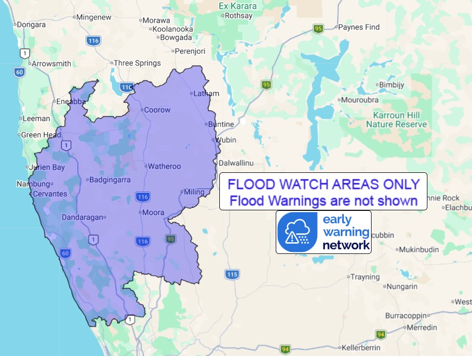
Flood Watch for the Moore and Hill River Catchments
Issued at 10:03 am AWST on Sunday 19 July 2026
Flood Watch Number: 5
ELEVATED RIVER LEVELS OCCURRING IN PARTS OF MOORE AND HILL RIVER
CATCHMENTS
Recent moderate rainfall across the Moore and Hill River
catchments has caused river level rises, with a minor flood peak
recorded at Long Pool Bridge on Saturday evening.
No further rainfall of significance is forecast over the Flood
Watch area, however elevated river and creek levels are likely to
continue during Sunday and possibly into Monday, with areas of
localised flooding and overland inundation possible across parts of
the Moore and Hill River catchments, including Moora.
Some communities and homesteads may be isolated. Check road
conditions before travelling.
Catchments likely to be affected include:
Moore and Hill Rivers
For the latest flood and weather warnings see
www.bom.gov.au/weather-and-climate/warnings-and-alerts
For the latest rainfall and river level information see
www.bom.gov.au/australia/flood
Safety Advice:
Don't drive, walk, swim or play in floodwater because it is
dangerous.
Stay away from flooded drains, rivers, streams and
waterways.
Obey road closure signs. Plan ahead so you don't drive on flooded
roads.
Check the ABC and local media for updates. The situation can
change quickly, so stay informed.
For local emergency management warnings and advice visit
www.emergency.wa.gov.au/.
For emergency assistance call SES on telephone number 132 500. In
life-threatening emergencies, call 000 (triple zero)
immediately.
Rainfall and River
Conditions Map
19/Jul/2026 02:17 AM