
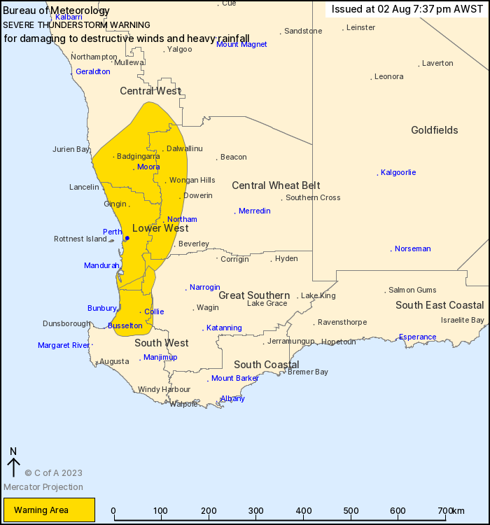
Source: Bureau of Meteorology
For people in Lower West and parts of Central West, South West,
Central Wheat Belt and Great Southern districts.
Issued at 7:37 pm Wednesday, 2 August 2023.
Severe thunderstorms ongoing in southern parts of the state
tonight.
Weather Situation: A cold front is crossing the southwestern
districts tonight, with severe thunderstorms developing on and
ahead of it.
Severe thunderstorms are likely to produce destructive winds over
the next several hours in the Lower West and parts of the Central
West, Central Wheat Belt and Great Southern districts. Locations
which may be affected include Perth, Mandurah, Moora, Northam,
Wongan Hills and Yanchep.
Severe thunderstorms are likely to produce damaging winds and
heavy rainfall that may lead to flash flooding over the next
several hours in parts of the Lower West, South West and Great
Southern districts. Locations which may be affected include
Bunbury, Collie and Harvey.
A 91 km/h gust was observed at Swanbourne at approximately 7:14
pm.
A 103 km/h gust was observed at Lancelin at approximately 6:20
pm.
A 111 km/h gust was observed at Garden Island at 7:04 pm
A 126 km/h gust was observed at Lancelin east at approximately
6:30 pm.
The Department of Fire and Emergency Services advises that people
should:
* If outside find safe shelter away from trees, power lines, storm
water drains and streams.
* Close your curtains and blinds, and stay inside away from
windows.
* Unplug electrical appliances and do not use land line telephones
if there is lightning.
* If there is flooding, create your own sandbags by using pillow
cases filled with sand and place them around doorways to protect
your home.
* If boating, swimming or surfing leave the water.
* Do not drive into water of unknown depth and current.
* Slow down and turn your headlights on.
* Be alert and watch for hazards on the road such as fallen power
lines and loose debris.
* If it is raining heavily and you cannot see, pull over and park
with your hazard lights on until the rain clears.
02/Aug/2023 11:46 AM


