
Source: Bureau of Meteorology
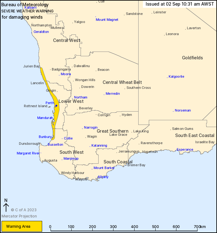
For people in parts of Lower West, Central West and South West
districts.
Issued at 10:31 am Saturday, 2 September 2023.
Damaging wind gusts possible from late this evening to early
Sunday morning.
Weather Situation: A cold front will strengthen as it moves across
southwestern WA overnight tonight into early Sunday morning. Strong
to locally damaging wind gusts are possible with the front and for
a few hours after its passage, particularly with squally shower
activity.
Gusty westerly winds with isolated DAMAGING WIND GUSTS of around
90 to 100 km/h are possible over the coast and adjacent inland
between Jurien Bay and Bunbury, including Perth, from late this
evening into the early hours of Sunday morning.
Conditions are expected to ease well before sunrise on
Sunday.
Locations which may be affected include Bunbury, Mandurah, Perth,
Jurien Bay, Lancelin and Yanchep.
The Department of Fire and Emergency Services advises that people
should:
* If outside find safe shelter away from trees, power lines, storm
water drains and streams.
* Close your curtains and blinds, and stay inside away from
windows.
* Unplug electrical appliances and do not use land line telephones
if there is lightning.
* If boating, swimming or surfing leave the water.
* Be alert and watch for hazards on the road such as fallen power
lines and loose debris.
* Keep away from flooded drains, rivers, streams and
waterways.
* Be careful of fallen trees, damaged buildings and debris.
* Be careful of fallen power lines. They are dangerous and should
always be treated as live.
* Assess your home, car and property for damage.
* If damage has occurred take photos and contact your insurance
company to organise permanent repairs.
* If your home or property has significant damage, like a badly
damaged roof or flooding, call the SES on 132 500.
02/Sep/2023 02:40 AM


