
Source: Bureau of Meteorology
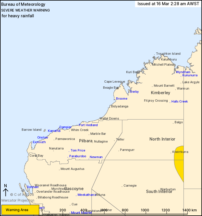
For people in parts of North Interior and South Interior
districts.
Issued at 2:28 am Monday, 16 March 2026.
Heavy rainfall occurring through the North and South Interior this
morning.
Weather Situation: A tropical low situated in northern WA rich
with tropical moisture brings the risk of heavy rainfall to the
Interior near the NT border this morning.
HEAVY RAINFALL which may lead to FLASH FLOODING is forecast for
parts of the North Interior and South Interior. Six-hourly rainfall
totals between 50 and 80 mm are likely.
Flood Watches and Warnings are current for the area. Please refer
to https://www.bom.gov.au/weather-and-climate/warnings-and-alerts/
for more information.
The Department of Fire and Emergency Services advises that people
should:
* If outside find safe shelter away from trees, power lines, storm
water drains and streams.
* Close your curtains and blinds, and stay inside away from
windows.
* Unplug electrical appliances and do not use land line telephones
if there is lightning.
* If boating, swimming or surfing leave the water.
* Be alert and watch for hazards on the road such as fallen power
lines and loose debris.
* Keep away from flooded drains, rivers, streams and
waterways.
* Be careful of fallen trees, damaged buildings and debris.
* Be careful of fallen power lines. They are dangerous and should
always be treated as live.
* Assess your home, car and property for damage.
* If damage has occurred take photos and contact your insurance
company to organise permanent repairs.
* If your home or property has significant damage, like a badly
damaged roof or flooding, call the SES on 132 500.
15/Mar/2026 07:49 PM

