
Source: Bureau of Meteorology
Initial Flood Watch for parts of the Northern Rivers
Issued at 1:34 pm AEDT on Thursday 12 February 2026 Flood Watch
Number: 1
MINOR FLOODING POSSIBLE IN THE NORTHERN RIVERS FROM FRIDAY
A cold front and its associated trough is crossing much of the
state during Thursday, before lingering and deepening about the
northeast from Friday and into the weekend.
Moderate to heavy rainfall is forecast from Thursday evening
through into the weekend across the Northern Rivers catchments.
Locally intense falls are also possible with thunderstorms from
Thursday evening through to Friday morning.
This rainfall may cause minor flooding in the Northern Rivers
catchments from late Friday.
The Northern Rivers catchments are relatively dry.
The exact location and timing of the heaviest falls remain
uncertain.
Localised river level rises and flash flooding are possible within
the areas of heaviest rainfall.
Flood classes (minor, moderate and major) are only defined for
catchments where the Bureau provides a flood warning service.
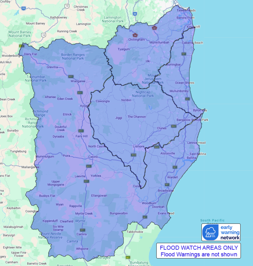
Catchments likely to be affected include:
Tweed and Rous Rivers Minor flooding
Brunswick River and Marshalls Creek Minor flooding
Wilsons River Minor flooding
Richmond River Minor flooding
For the latest flood and weather warnings see
www.bom.gov.au/weather-and-climate/warnings-and-alerts
For the latest rainfall and river level information see
www.bom.gov.au/australia/flood
Safety Advice:
* Don't drive, walk, swim or play in floodwater because it is
dangerous.
* Stay away from flooded drains, rivers, streams and
waterways.
* Obey road closure signs. Plan ahead so you don't drive on
flooded roads.
* Check the ABC and local media for updates. The situation can
change quickly, so stay informed.
* For local emergency management warnings and advice visit
www.ses.nsw.gov.au.
Rainfall and River
Conditions Map
12/Feb/2026 02:59 AM


