
Source: Bureau of Meteorology
Issued at 12:46 pm EST on Monday 10 June 2024
By the Bureau of Meteorology, Hobart.
Flood Watch Number: 1
RIVER LEVEL RISES AND AREAS OF MINOR FLOODING MAY DEVELOP FROM
TUESDAY, WITH ISOLATED MODERATE FLOODING POSSIBLE
A cold front is forecast to pass over Tasmania from late Monday
and into Tuesday producing moderate rainfall totals.
Catchments are average to moderately wet across the flood watch
area.
Rainfall totals of 40 - 70 mm are possible over the flood watch
area from late Monday into Tuesday, with higher falls possible
particularly about elevated locations.
This rainfall may result in river level rises and minor flooding
across the flood watch area from Tuesday, with isolated moderate
flooding possible.
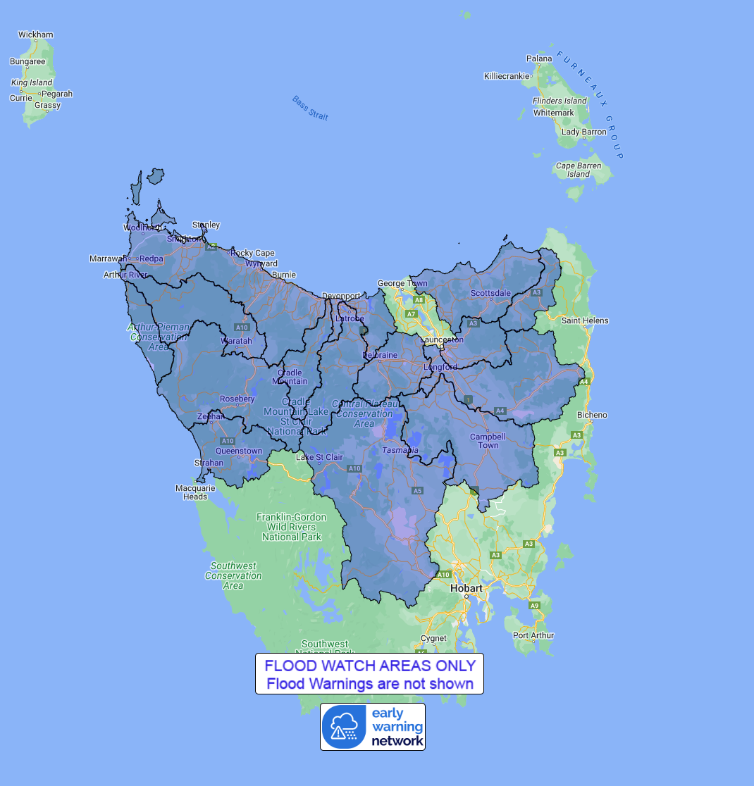
Catchments likely to be affected include:
North Esk River
South Esk River
Meander River
Macquarie River
Ringarooma River
North Coastal Rivers
Mersey River
Forth River
Northwest and Central Coastal Rivers
Arthur River
Nelson Bay Coastal Rivers
Pieman River
King-Henty Rivers
Derwent River
Note: This Flood Watch is a "heads up" for possible future
flooding and is NOT a Flood Warning. The Bureau of Meteorology does
not provide a flood warning service for all of the catchments
covered by this flood watch. For more information on the Flood
Watch Service:
http://www.bom.gov.au/water/floods/floodWarningServices.shtml
For the latest warnings see www.bom.gov.au/tas/warnings
For the latest rainfall and river level information see
www.bom.gov.au/tas/flood
For the latest weather forecast see
www.bom.gov.au/tas/forecasts
Flood Safety Advice:
SES flood warnings can be found at TasALERT.com
Flood and storm safety advice is available at
www.ses.tas.gov.au
Road closure information is available at
www.police.tas.gov.au
For emergency assistance call the SES on telephone number 132
500.
For life threatening situations, call 000 immediately.
Rainfall and River
Conditions Map
10/Jun/2024 02:52 AM

