Latest EWN Severe Weather Alerts
17/Jul/2026 03:51 AM
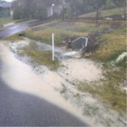
WA Flood Watch: Moore and Hill River Catchments
Source: Bureau of Meteorology Refer to EmergencyWA for AWS alerts ssued at 11:31 am AWST on Friday 17 July 2026 Flood Watch Number: 3 FLOODING POSSIBLE IN MOORE AND HILL RIVER CATCHMENTS FROM LATE FRIDAY A slow-moving trough is lingering over th ... Read more...16/Jul/2026 09:14 AM
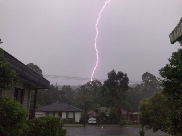
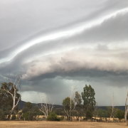
WA Severe Thunderstorm Warning: Heavy Rain
Source: Bureau of Meteorology Refer to EmergencyWA for AWS alerts For people in parts of Greater Perth area. Issued at 5:07 pm Thursday, 16 July 2026. Heavy rainfall possible on the Lower Western coast south of Perth. The Bureau of Meteorology w ... Read more...16/Jul/2026 08:39 AM
WA Severe Thunderstorm Warning: Heavy Rain
Source: Bureau of Meteorology Refer to EmergencyWA for AWS alerts For people in parts of Lower West district. Issued at 4:32 pm Thursday, 16 July 2026. Heavy rainfall developing on the Lower Western coast south of Perth. Weather Situation: A slo ... Read more...16/Jul/2026 04:15 AM
WA Flood Watch: Moore and Hill River Catchments
Source: Bureau of Meteorology Refer to EmergencyWA for AWS alerts Issued at 11:36 am AWST on Thursday 16 July 2026 Flood Watch Number: 2 FLOODING POSSIBLE IN MOORE AND HILL RIVER CATCHMENTS FROM LATE FRIDAY A series of cold fronts will impact th ... Read more...15/Jul/2026 06:31 AM
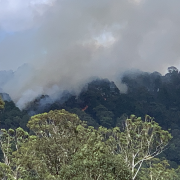
NT Bushfire Watch & Act: Girraween Road, Girraween
Source: NT Fire Incidents Bushfire Girraween Road, GIRRAWEEN Notified: 15/07/2026 16:00 Fire Type Bushfire Location Girraween Road, GIRRAWEEN Current Situation Response Underway Status Going Alert Level Watch and Act Risks Active fire ... Read more...15/Jul/2026 02:31 AM
WA Flood Watch: Moore and Hill Rivers
Source: Bureau of Meteorology Refer to EmergencyWA for AWS alerts This Flood Watch provides early advice of possible flooding within the specified catchments Initial Flood Watch for the Moore and Hill River Catchments Issued at 10:23 am AWST on W ... Read more...14/Jul/2026 05:06 AM
NT Bushfire Watch & Act: Berry Springs
Source: NT Fire Incidents Hopewell Road, BERRY SPRINGS Notified: 14/07/2026 14:00 Fire Type Bushfire Location Hopewell Road, BERRY SPRINGS Current Situation Response Underway Status Going Alert Level Watch and Act Risks Active fire may ... Read more...13/Jul/2026 05:09 AM
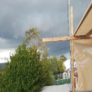
TAS Severe Thunderstorm Warning: Heavy Rain
Source: Bureau of Meteorology For people in North West Coast and parts of Central North, Central Plateau and Western Forecast Districts. Issued at 3:04 pm Monday, 13 July 2026. Damaging winds in fast moving thunderstorms Weather Situation: A fast ... Read more...13/Jul/2026 12:55 AM
TAS Severe Weather Warning: Damaging Winds
Source: Bureau of Meteorology For people in King Island, Furneaux Islands and parts of Western, North East, North West Coast and Central North Forecast Districts. Issued at 10:44 am Monday, 13 July 2026. Damaging winds possible about northern Tasm ... Read more...13/Jul/2026 12:54 AM
TAS Severe Weather Warning: Damaging Winds
Source: Bureau of Meteorology For people in King Island, Furneaux Islands and parts of Western, North East, North West Coast and Central North Forecast Districts. Issued at 10:44 am Monday, 13 July 2026. Damaging winds possible about northern Tasm ... Read more...13/Jul/2026 12:51 AM
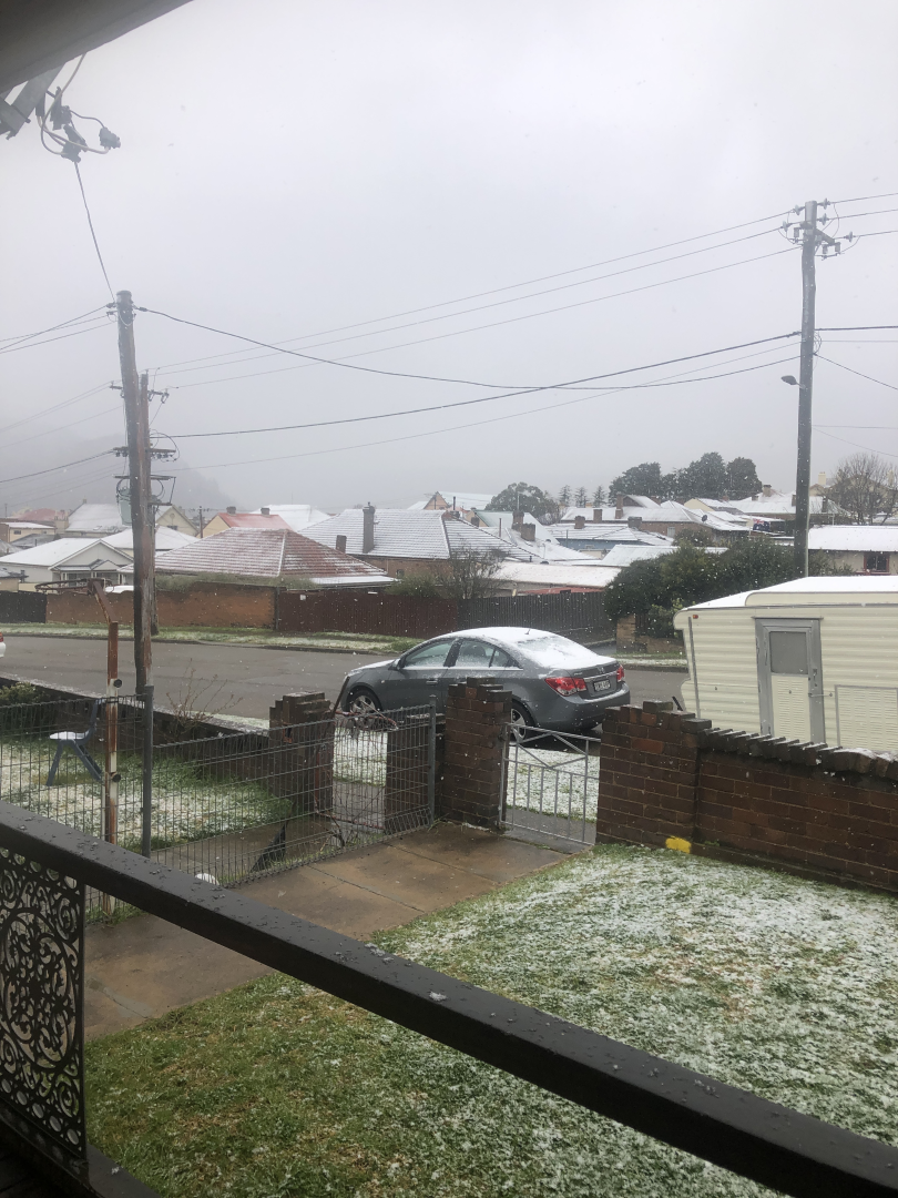
VIC Severe Weather Warning: Damaging Winds
Source: Bureau of Meteorology Refer to VicEmergency for AWS alerts For people in parts of North East, East Gippsland and West and South Gippsland Forecast Districts. Issued at 10:43 am Monday, 13 July 2026. Damaging winds with possible blizzard c ... Read more...13/Jul/2026 12:49 AM
NSW Severe Weather Warning: Damaging Winds
Source: Bureau of Meteorology For people in parts of Snowy Mountains Forecast District. Issued at 10:41 am Monday, 13 July 2026. Damaging winds and possible blizzard conditions over alpine areas today. Weather Situation: Northwesterly winds are s ... Read more...12/Jul/2026 07:12 AM
TAS Severe Weather Warning: Damaging Winds
Source: Bureau of Meteorology For people in King Island, Furneaux Islands and parts of Western, North East, North West Coast and Central North Forecast Districts. Issued at 4:56 pm Sunday, 12 July 2026. Damaging winds developing on Monday about we ... Read more...12/Jul/2026 06:38 AM
VIC Severe Weather Warning: Damaging Winds
Source: Bureau of Meteorology Refer to VicEmergency for AWS alerts For people in parts of North East, East Gippsland and West and South Gippsland Forecast Districts. Issued at 4:30 pm Sunday, 12 July 2026. Damaging winds, with possible blizzard c ... Read more...12/Jul/2026 04:22 AM
NSW Severe Weather Warning: Damaging Winds
Source: Bureau of Meteorology For people in parts of Snowy Mountains Forecast District. Issued at 1:55 pm Sunday, 12 July 2026. Vigorous northwesterly winds, with possible blizzard conditions, about the alpine region. Weather Situation: Strengthe ... Read more...12/Jul/2026 12:22 AM
TAS Severe Weather Warning: Damaging Winds
Source: Bureau of Meteorology For people in King Island, Furneaux Islands and parts of Western and North West Coast Forecast Districts. Issued at 10:17 am Sunday, 12 July 2026. Damaging winds developing on Monday across the southwest, west coast a ... Read more...11/Jul/2026 06:22 PM
NSW Severe Thunderstorm Warning: Damaging Winds
Source: Bureau of Meteorology For people in parts of Illawarra, Central Tablelands, Southern Tablelands, Hunter, South Coast and Central West Slopes and Plains Forecast Districts. Issued at 4:16 am Sunday, 12 July 2026. Isolated damaging winds abo ... Read more...11/Jul/2026 05:27 PM
NSW Severe Thunderstorm Warning: Damaging Winds
Source: Bureau of Meteorology For people in parts of Illawarra, South Coast, Central Tablelands, Southern Tablelands, Central West Slopes and Plains, South West Slopes and Snowy Mountains Forecast Districts. Issued at 3:23 am Sunday, 12 July 2026. ... Read more...11/Jul/2026 04:49 PM
NSW Severe Thunderstorm Warning: Damaging Winds
Source: Bureau of Meteorology For people in Southern Tablelands, Australian Capital Territory and parts of Central Tablelands, Central West Slopes and Plains, South West Slopes, Snowy Mountains and South Coast Forecast Districts. Issued at 2:45 am ... Read more...11/Jul/2026 03:55 PM
NSW Severe Thunderstorm Warning: Damaging Winds
Source: Bureau of Meteorology For people in South West Slopes, Australian Capital Territory and parts of Southern Tablelands, Snowy Mountains, Central Tablelands and Central West Slopes and Plains Forecast Districts. Issued at 1:48 am Sunday, 12 Ju ... Read more...11/Jul/2026 01:55 PM
NSW Severe Thunderstorm Warning: Damaging Winds
Source: Bureau of Meteorology For people in parts of Southern Tablelands, South West Slopes, Riverina, Central West Slopes and Plains and Snowy Mountains Forecast Districts. Issued at 11:50 pm Saturday, 11 July 2026. Isolated damaging winds about ... Read more...11/Jul/2026 12:57 PM
NSW Severe Thunderstorm Warning: Damaging Winds
Source: Bureau of Meteorology For people in parts of Riverina and South West Slopes Forecast Districts. Issued at 10:52 pm Saturday, 11 July 2026. Isolated damaging winds about a line of showers this evening. Weather Situation: A moist and unstab ... Read more...11/Jul/2026 12:55 PM
VIC Severe Thunderstorm Warning: Damaging Winds
Source: Bureau of Meteorology Refer to VicEmergency for AWS alerts For people in parts of North East Forecast District. Issued at 10:51 pm Saturday, 11 July 2026. Isolated damaging winds about a line of showers and thunderstorms this evening. We ... Read more...11/Jul/2026 12:09 PM
NSW Severe Thunderstorm Warning: Damaging Winds
Source: Bureau of Meteorology For people in parts of Riverina Forecast District. Issued at 10:00 pm Saturday, 11 July 2026. Isolated damaging winds about a line of showers and thunderstorms this evening. Weather Situation: A moist and unstable ai ... Read more...11/Jul/2026 11:50 AM
VIC Severe Thunderstorm Warning: Damaging Winds
Source: Bureau of Meteorology Refer to VicEmergency for AWS alerts For people in parts of Northern Country and North East Forecast Districts. Issued at 9:44 pm Saturday, 11 July 2026. Isolated damaging winds about a line of showers and thundersto ... Read more...